

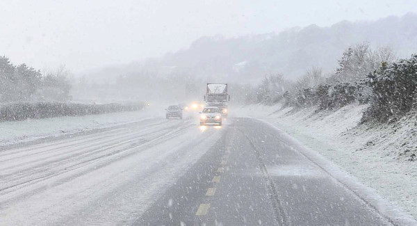
Update: Roads are wet across the country this morning, but as yet no ice has been reported.
However an orange weather warning remains in place and Met Éireann’s predicting that low temperatures will remain until Sunday.
V cold today. Shwrs of rain/hail turning increasingly to sleet/snow at lower levels this morn, mainly over N, W & SW and in remaining....
— Met Éireann (@MetEireann) January 12, 2017
Tonight is thought to be cold and blustery with fairly widespread sleet and snow showers.
.... areas this aft & eve. Some thunderstorms likely to develop also. Highs just 2 to 4 deg, feeling colder in strengthening W to NW wind.
— Met Éireann (@MetEireann) January 12, 2017
Lowest temperatures are though to be 1 to -2 degrees.
The weekend is expected to be frosty with bright spells, although a lot of cloud in the main with some rain and drizzle.
Earlier: Motorists are being warned to prepare for difficult driving conditions this morning following freezing temperatures overnight.
V cold today. Shwrs of rain/hail turning increasingly to sleet/snow at lower levels this morn, mainly over N, W & SW and in remaining....
— Met Éireann (@MetEireann) January 12, 2017
An orange weather warning is in place for Cavan, Monaghan, Donegal, Leitrim, Mayo and Sligo.
.... areas this aft & eve. Some thunderstorms likely to develop also. Highs just 2 to 4 deg, feeling colder in strengthening W to NW wind.
— Met Éireann (@MetEireann) January 12, 2017
Heavy sleet and possibly snow is expected across the north, with ice said to be a particular danger.
Sean Hogan is chair of the emergency co-ordination group for severe weather: “We are advising people to heed the conditions locally in their areas, conditions will vary across the country, but people should be aware of the conditions.
“The conditions will be tough enough, it will be cold, snow is never pleasant when you are travelling on the road and with winds you can get blizzard type of conditions when you get snow and wind combined.”
